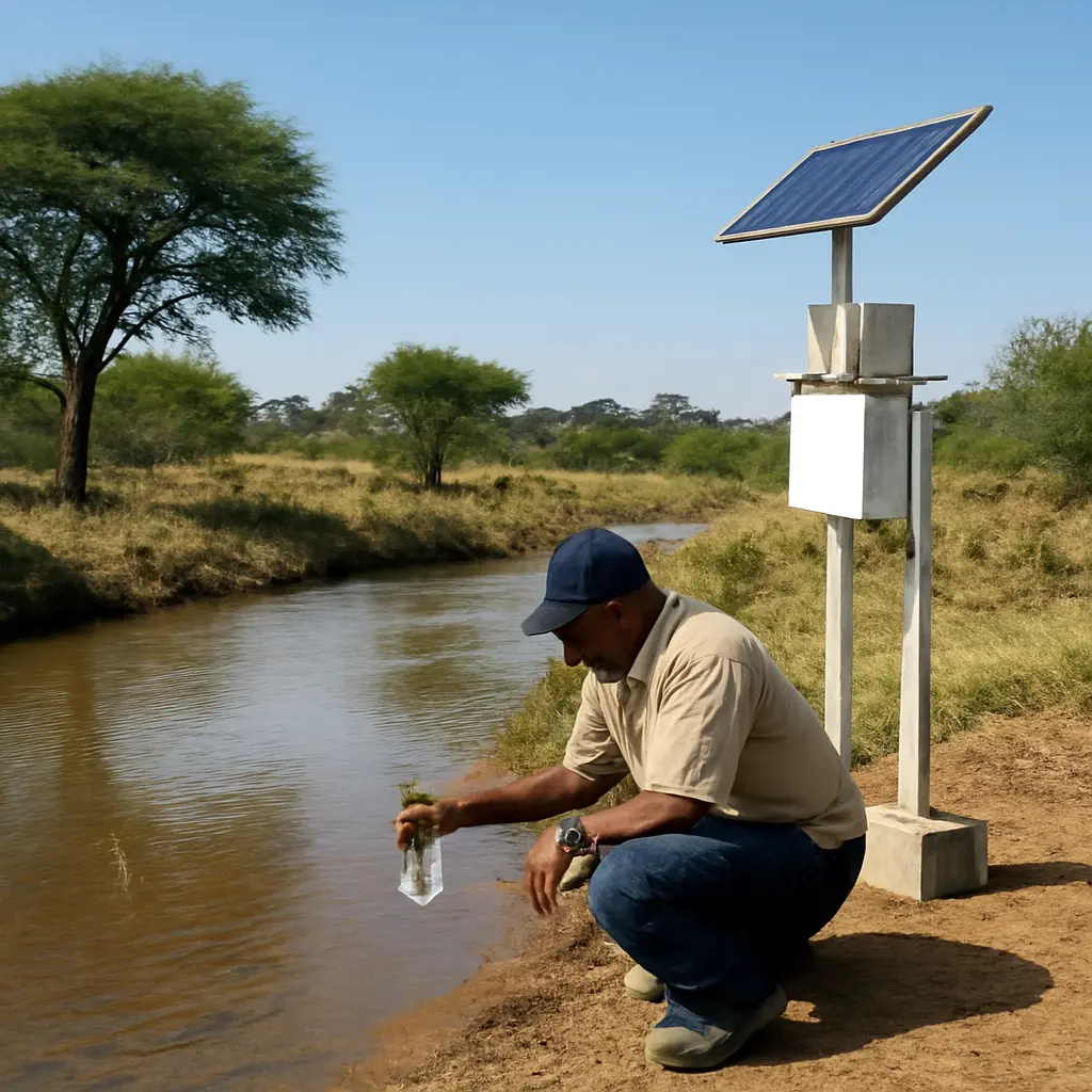
A Practical Starting Point for Water Monitoring Networks in Africa
Water-monitoring networks are coordinated systems of sampling locations, instruments, laboratories, and data practices used to track the quantity and quality of water over time. For African countries and river basins, a practical starting point is not to install sensors everywhere: it is to identify decisions the data must support, build on existing institutions and stations, and expand a maintainable network in stages. This approach matters because the World Health Organization and UNICEF reported that 411 million people in sub-Saharan Africa lacked at least basic drinking-water services in 2022, while the World Meteorological Organization has highlighted persistent gaps in hydrological observations across Africa. A useful starting network therefore connects community and utility needs with river-basin monitoring, groundwater observation, laboratory quality control, and reliable data sharing.
Water-monitoring networks serve decision-making across Africa
A water-monitoring network is an organized set of sites and procedures for collecting, validating, managing, and communicating observations about water. The United States Geological Survey describes water quality as the suitability of water for a particular use, assessed through selected physical, chemical, and biological characteristics. In practice, a network may monitor water availability, water quality, or both, using measurements made in the field and in laboratories.
The network’s purpose should determine what it measures. A drinking-water regulator may need microbial indicators and chemical risks at sources and distribution points; a drought-planning agency may need rainfall, river flow, reservoir levels, and groundwater levels; and a pollution-control authority may need upstream and downstream measurements near discharges. The African Union’s Africa Water Vision 2025 emphasized integrated water-resources management, while the Sustainable Development Goals include targets for water quality, water-use efficiency, and water-related ecosystems. These objectives make comparable, sustained observations more useful than isolated sampling campaigns.
Surface-water monitoring
Surface-water monitoring tracks rivers, lakes, wetlands, and reservoirs. Common measurements include water level, flow, temperature, turbidity, electrical conductivity, dissolved oxygen, and nutrients. A basic station can pair a staff gauge or pressure sensor with periodic field visits; more advanced sites may use telemetry to transmit data automatically. Station placement should reflect decisions and hydrology: for example, upstream and downstream of a town, near a drinking-water intake, at a major tributary, or at a cross-border flow point.
The World Meteorological Organization’s hydrological-observation guidance stresses that measurements need consistent methods, documented metadata, and ongoing operation. A sensor reading without a known location, time, calibration history, and quality flag is difficult to compare or trust. Where power and communications are unreliable, staff gauges, manual readings, and scheduled sample collection can provide a resilient baseline while telemetry is added selectively.
Groundwater monitoring
Groundwater monitoring observes aquifer levels and, where relevant, groundwater chemistry. A network commonly uses selected boreholes or dedicated observation wells, with repeated measurements of water level and periodic testing for parameters such as salinity, nitrate, fluoride, or arsenic. Site selection should represent different aquifers and levels of pressure, rather than simply the wells that are easiest to access.
The International Groundwater Resources Assessment Centre (IGRAC) has documented the importance of groundwater information for assessment and management, especially where monitoring data are fragmented. A practical design records well construction, aquifer assignment, measurement method, and seasonal timing. This helps distinguish long-term depletion from ordinary seasonal variation and supports early investigation where water levels or quality change unexpectedly.
Drinking-water and source-water surveillance
Drinking-water surveillance evaluates whether water is safe from source through treatment and distribution. It can combine sanitary inspections, operational checks, and laboratory analysis. The WHO Guidelines for Drinking-water Quality recommend a preventive, risk-based approach, including water safety plans that identify hazards and control measures throughout a supply system. Testing only at a treatment plant outlet can miss contamination in catchments, storage, or distribution pipes.
The WHO/UNICEF Joint Monitoring Programme estimated that 411 million people in sub-Saharan Africa lacked at least basic drinking-water services in 2022. That service-access statistic is not itself a water-quality measurement, but it underscores why monitoring must be connected to action: identifying a hazard, notifying the responsible operator, and confirming that corrective measures worked.
A practical water-monitoring network starts with priorities and existing capacity
A practical network is a fit-for-purpose system that can produce credible information at a cost and level of complexity local institutions can sustain. The United Nations Environment Programme’s monitoring and assessment work, and the WMO’s guidance on hydrological observations, both support coordinated approaches in which objectives, methods, responsibilities, and data management are planned together. The key characteristics are clear monitoring questions, representative sites, consistent procedures, quality assurance, defined institutional roles, and a budget for recurring operation.
The design should account for substantial differences among African settings: arid basins, humid tropical catchments, densely populated cities, remote rural areas, and transboundary rivers all present different monitoring needs. The Nile Basin Initiative, for example, coordinates cooperation among basin countries and supports shared water-resource information. Such basin-scale work illustrates why national networks benefit from compatible methods and data exchange, while still addressing local priorities.
Begin with decisions, hazards, and users
A monitoring objective states what decision the observations will inform. Before choosing instruments, agencies should identify users—such as water utilities, public-health teams, basin authorities, farmers, and communities—and specify what action a result could trigger. Examples include issuing a contamination advisory, adjusting reservoir operations, investigating a suspected industrial discharge, or restricting abstraction during low flows.
A simple monitoring plan can link each question to a parameter, location, frequency, method, responsible organization, and response pathway. This prevents a common failure: collecting data that are scientifically interesting but not timely, accessible, or actionable for the people responsible for water management.
Map existing stations, laboratories, and data before adding equipment
An inventory identifies what already exists: active and inactive stations, observation wells, water-supply testing, university laboratories, staff expertise, data archives, and community reporting systems. The inventory should record station location, monitoring history, measured variables, equipment condition, data gaps, and ownership. Comparing these resources with priority questions reveals where a new site is genuinely needed and where an existing site could be restored.
This step is particularly important where several agencies collect overlapping observations using different methods. Shared station identifiers, agreed sampling protocols, and documented data formats can improve comparability without requiring every organization to merge its mandate or database.
Choose a tiered network that can be maintained
A tiered design combines a small number of continuous or high-frequency sentinel stations with a wider set of lower-cost sites visited periodically. Sentinel stations can provide timely information at high-risk locations, while manual sampling expands geographic coverage. Community-based observations can add local context, provided volunteers receive clear protocols, suitable tools, and feedback on how their reports are used.
Technology should match the operating environment. Automatic sensors and satellite communications can be valuable where rapid alerts matter, but they require calibration, replacement parts, power, connectivity, and trained staff. Manual methods may be more dependable where those supports are absent. A useful planning chart would compare each candidate station’s decision value, installation cost, annual operating cost, access difficulty, and expected data reliability before investment is made.
Build quality assurance and laboratory capacity into the design
Quality assurance and quality control (QA/QC) are the procedures that prevent, detect, and document errors in field measurements and laboratory results. They include instrument calibration, sample labeling, blanks and duplicates where appropriate, chain-of-custody records, laboratory method documentation, and review of implausible values. Data should carry quality flags rather than silently mixing confirmed observations with provisional or suspect readings.
For microbiological and chemical testing, laboratories need suitable methods, trained analysts, reliable reagents, and participation in proficiency testing where available. The WHO’s drinking-water guidance emphasizes risk management and verification; a monitoring network can support both by pairing operational checks with periodic independent testing. Regional laboratory collaboration can also help countries share specialist capacity and reduce the cost of maintaining rarely used tests at every local facility.
Data governance turns observations into usable evidence
Data governance defines who collects, owns, checks, stores, shares, and acts on monitoring information. A sound arrangement assigns responsibilities among water ministries, meteorological and hydrological services, environmental regulators, public-health agencies, utilities, research institutions, and basin organizations. Without those agreements, datasets can remain siloed, quality issues may go unresolved, and warnings may not reach decision-makers.
The WMO’s hydrological information practices and the United Nations’ Sustainable Development Goal monitoring framework both rely on traceable, methodologically clear information. For a national or basin network, useful metadata include station coordinates, units, sampling frequency, analytical method, detection limits, equipment history, and data-quality status. Common formats and documented procedures make it easier to compare observations across agencies and borders.
Use shared standards while respecting local context
Shared standards make results comparable; local adaptation makes them relevant. Agencies can agree on core definitions, units, laboratory methods, and reporting intervals while adding parameters needed for local geology, climate, pollution sources, or public-health concerns. For transboundary waters, basin organizations can help align methods and exchange data, while national agencies retain responsibility for domestic regulation and response.
The African Union’s Africa Water Vision promotes cooperation and integrated management of water resources. In practical terms, this means that neighboring jurisdictions should coordinate on station locations and timing where shared rivers or aquifers are concerned, and document any differences that prevent direct comparison.
Publish data with context and appropriate safeguards
Publishing validated data, methods, and uncertainty helps utilities, researchers, communities, and governments use evidence consistently. Public dashboards can show trends and alerts, but they should explain measurement units, sampling frequency, quality status, and limitations. Sensitive infrastructure details or personal information may require restricted access, yet those safeguards should not become a reason to withhold general environmental information unnecessarily.
A useful reporting system distinguishes a measurement from its interpretation. For instance, a change in turbidity may signal a problem requiring investigation, but it does not by itself establish that water is unsafe. Clear communication should state what is known, what remains uncertain, who is responsible for follow-up, and when an update is expected.
Implementation succeeds through staged investment and local ownership
Network implementation is the process of moving from priority questions to operating stations, reliable datasets, and documented management responses. A staged approach reduces the risk of buying equipment that cannot be maintained and allows early lessons to improve later expansion. It also makes it easier to track whether monitoring is improving decisions rather than merely increasing the volume of data.
Pilot, evaluate, and expand
A pilot should test a small, representative set of sites and the full operating chain: access, sampling, transport, laboratory turnaround, data validation, reporting, and response. Evaluation measures can include the proportion of planned samples collected, station uptime, data completeness, laboratory turnaround time, cost per valid observation, and the number of management actions informed by results. Expansion should follow evidence that the system can be operated and used.
A practical sequence is to define priority decisions, inventory current capacity, select sentinel and routine sites, agree on methods and responsibilities, pilot the system, review performance, and then expand coverage. The sequence is more important than starting with a particular sensor brand or a fixed number of stations.
Fund the full life cycle, not only installation
Life-cycle financing covers installation, staff, travel, calibration, consumables, laboratory analysis, communications, repairs, data storage, and eventual replacement. A network with many unattended devices may appear modern but deliver little value if batteries fail or calibration lapses. Budgets should therefore distinguish one-time capital costs from recurring operating costs and identify who will pay each.
Partnerships among governments, utilities, universities, basin organizations, and development partners can help fund equipment and training, but long-term responsibility should be assigned before a project ends. Local technicians and analysts are essential: training should include routine maintenance, safety, sampling, data handling, and troubleshooting, with practical plans for retaining staff and replacing skills when personnel move on.
Connect monitoring to alerts and community feedback
An alert protocol specifies thresholds, verification steps, responsible contacts, and public communication for events such as contamination, floods, drought, or sudden changes in water levels. Thresholds should be appropriate to the parameter and intended use, and an unexpected observation should generally be checked before it prompts a high-consequence response. Monitoring is most useful when communities and operators know how to report changes and receive a timely explanation of follow-up.
For example, a source-water station showing a sudden rise in turbidity could trigger a field check, confirmatory sampling, and communication with a treatment operator. The reading becomes actionable only when it is tied to a defined procedure, an accountable institution, and an effective channel for communicating risk.
Conclusion: start small, standardize, and sustain
A practical starting point for water-monitoring networks in Africa is a decision-led, tiered system that builds on existing stations and skills. Surface-water, groundwater, and drinking-water monitoring each answer different questions; shared methods, QA/QC, clear data responsibilities, and life-cycle funding make their observations more reliable and useful. The scale of drinking-water service gaps reported by WHO and UNICEF, together with the need for stronger hydrological observations highlighted by WMO, reinforces the importance of turning monitoring into timely protection and better allocation.
Agencies and partners can begin by agreeing on a short list of priority decisions, mapping current capacity, piloting a manageable set of sites, and publishing validated results with clear explanations. Further reading should include the WHO Guidelines for Drinking-water Quality, WMO guidance on hydrological observations, the African Union’s Africa Water Vision, and relevant basin or national water-monitoring plans. The goal is not simply more measurements, but dependable evidence that communities and institutions can act on.
Sources: World Health Organization and UNICEF Joint Monitoring Programme, Progress on household drinking water, sanitation and hygiene 2000–2022: Special focus on gender, https://washdata.org/reports/jmp-2023-wash-households; World Meteorological Organization, Hydrological Observations, https://wmo.int/activities/hydrological-observations; United States Geological Survey, Water Quality, https://www.usgs.gov/special-topics/water-science-school/science/water-quality; World Health Organization, Guidelines for Drinking-water Quality: Fourth Edition Incorporating the First and Second Addenda, https://www.who.int/publications/i/item/9789240045064; African Union, Africa Water Vision 2025, https://au.int/en/documents/20040415/africa-water-vision-2025; International Groundwater Resources Assessment Centre, Groundwater Monitoring, https://www.un-igrac.org/; Nile Basin Initiative, Nile Basin Decision Support System, https://nilebasin.org/; United Nations Environment Programme, Freshwater Ecosystems and Water Quality, https://www.unep.org/explore-topics/water.